| Top Level: |
|
       |

| Peer Level: |
     |
|
|
Child Level:
 |
Workflows: Precise Vertical Geometry TechniquesMerging Ramps - Vertical
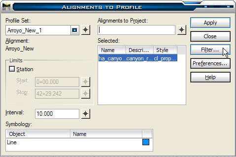
When designing the vertical alignment of a ramp, the "boundary" or match conditions at the ends of the ramp must be known. InRoads has a number of ways to do this, either by projecting the Vertical Alignment of a mainline alignment or by using the many Profile Surface display tools.
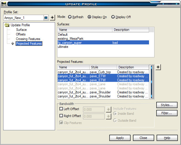
InRoads>Evaluation>Profile>Update Profile can be used to project any Surface Feature to the Profile. The (Surface View>)Update 3D/Plan, Update Profile and Update Cross Section commands are the Feature Display Managers for the InRoads Civil Engineering Database (dtm's: they're not just for triangles anymore). These three commands let you display engineering objects in Plan, Profile and Cross Section. If you need to add something to a profile or cross section set that you've already cut, use the Update commands. If you've cut a profile and need to add (project) a proposed mainline ETW to it, use Update Profile. The form is somewhat complicated, but it provides logical and precise control of what you want to do. It is consistent with Update 3D/Plan and Cross Section commands.
Select "Display On", "Projected Features", which Surface and which Features to Project and hit Apply. Annotate Feature, Annotate Feature in Profile and Annotate Feature in Cross Section provide the ability to Display the various properties of the displayed features (again, think GIS database for Civil Engineers).
|
|